Urban Planning Study of The City of Bata and its Ensanche (Equatorial Guinea)
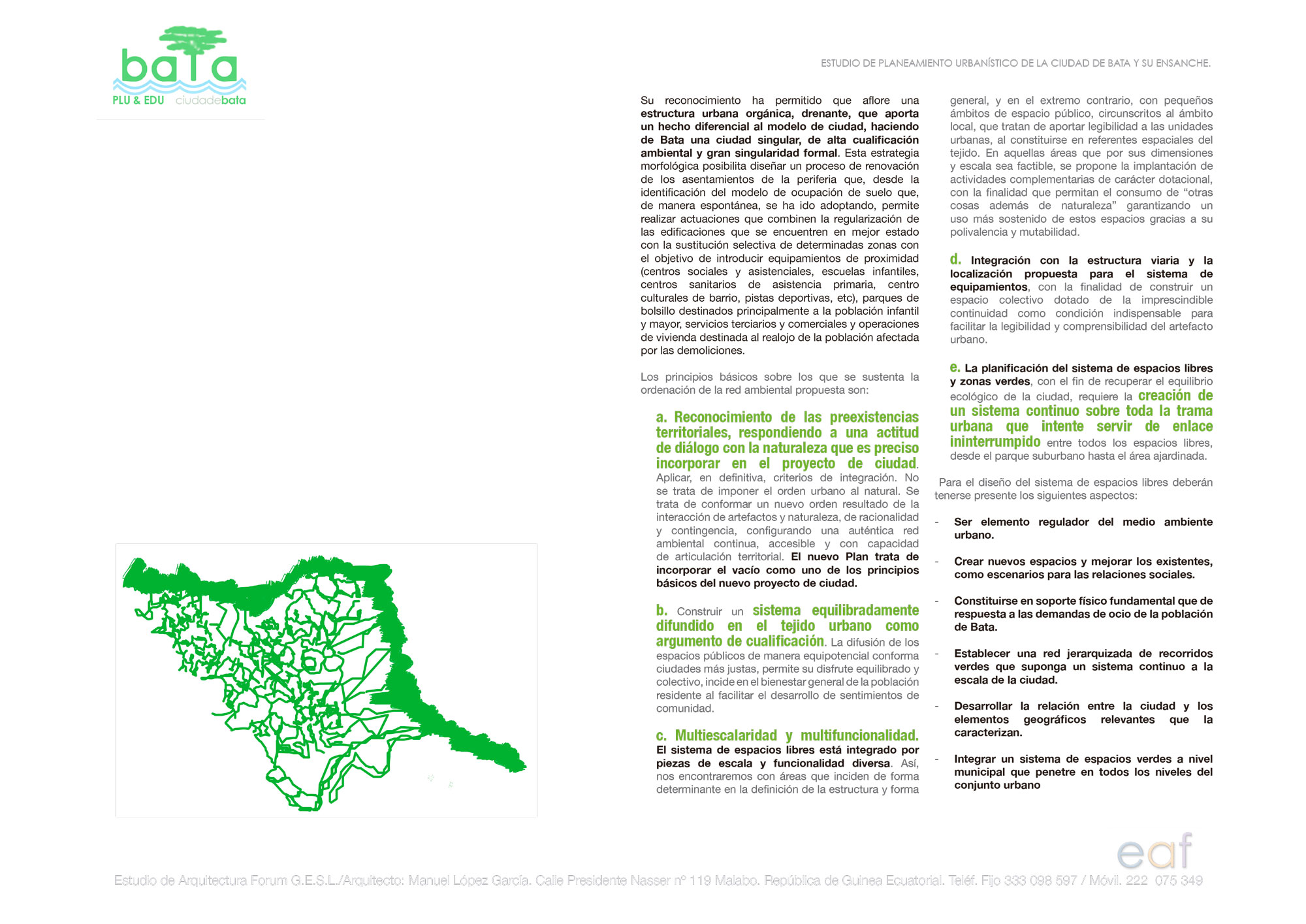
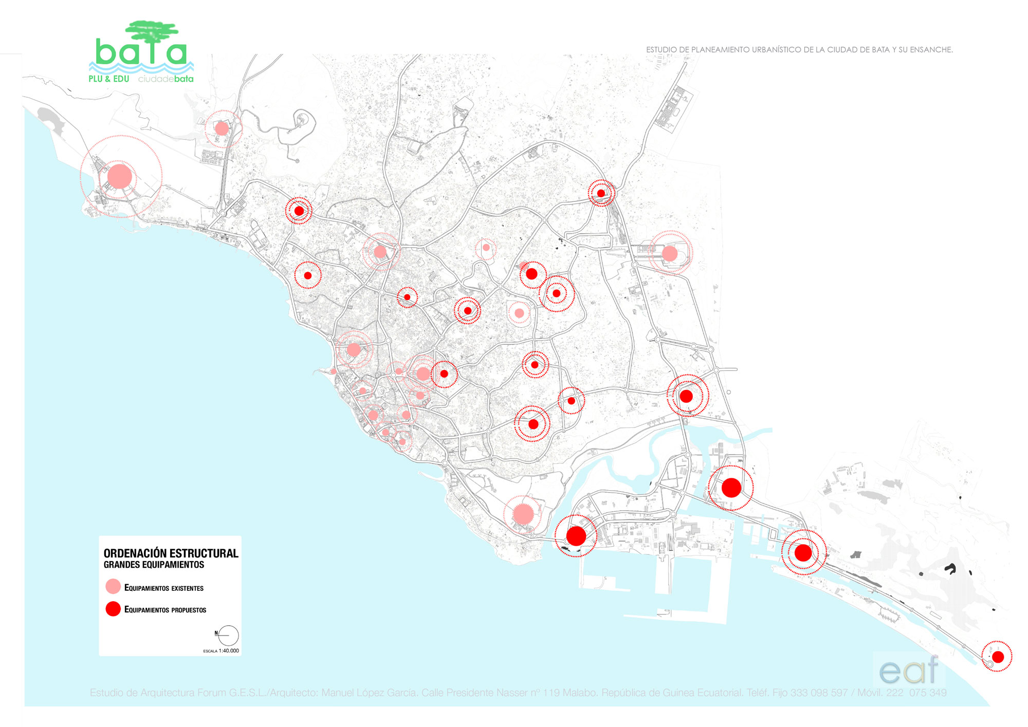
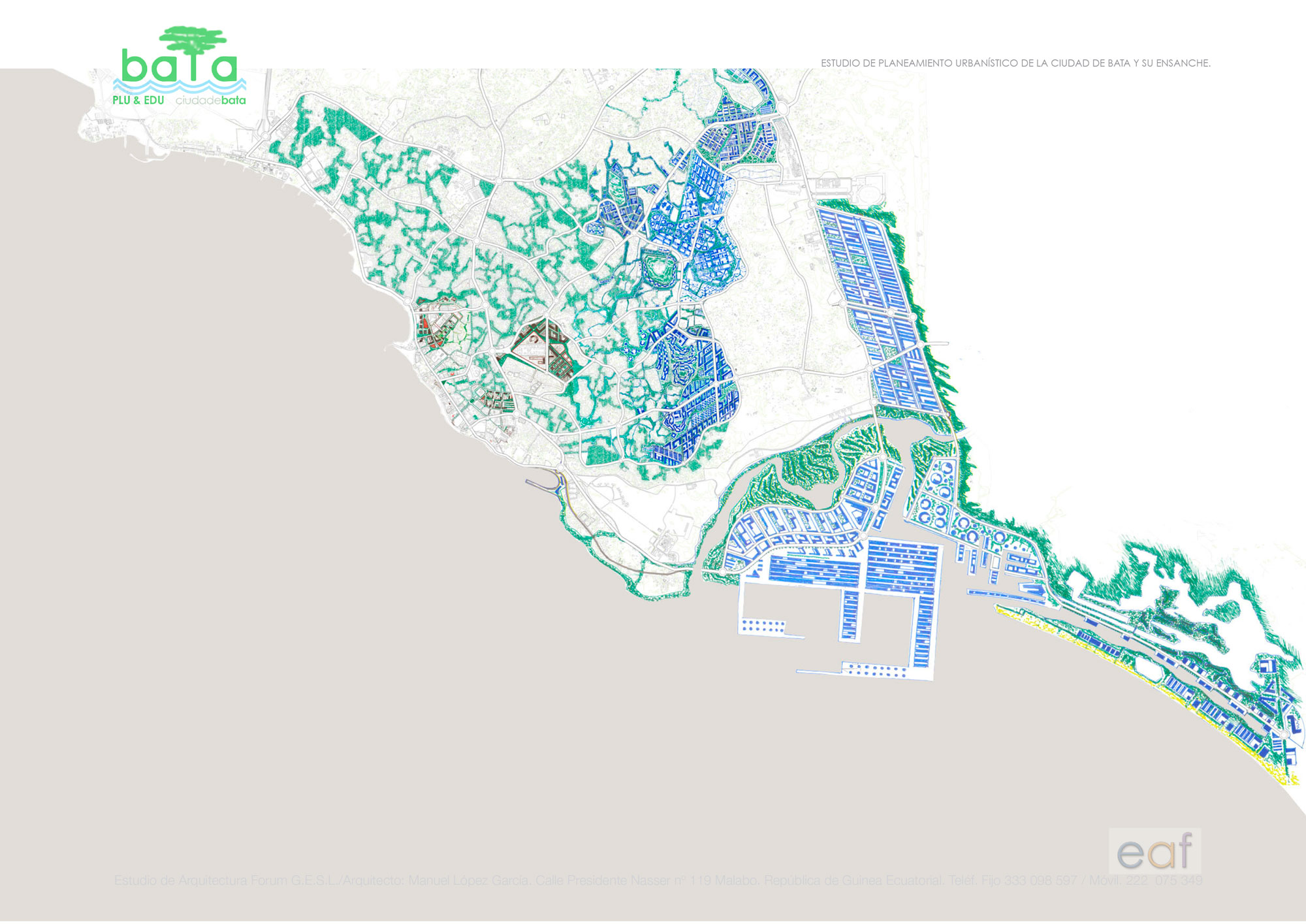
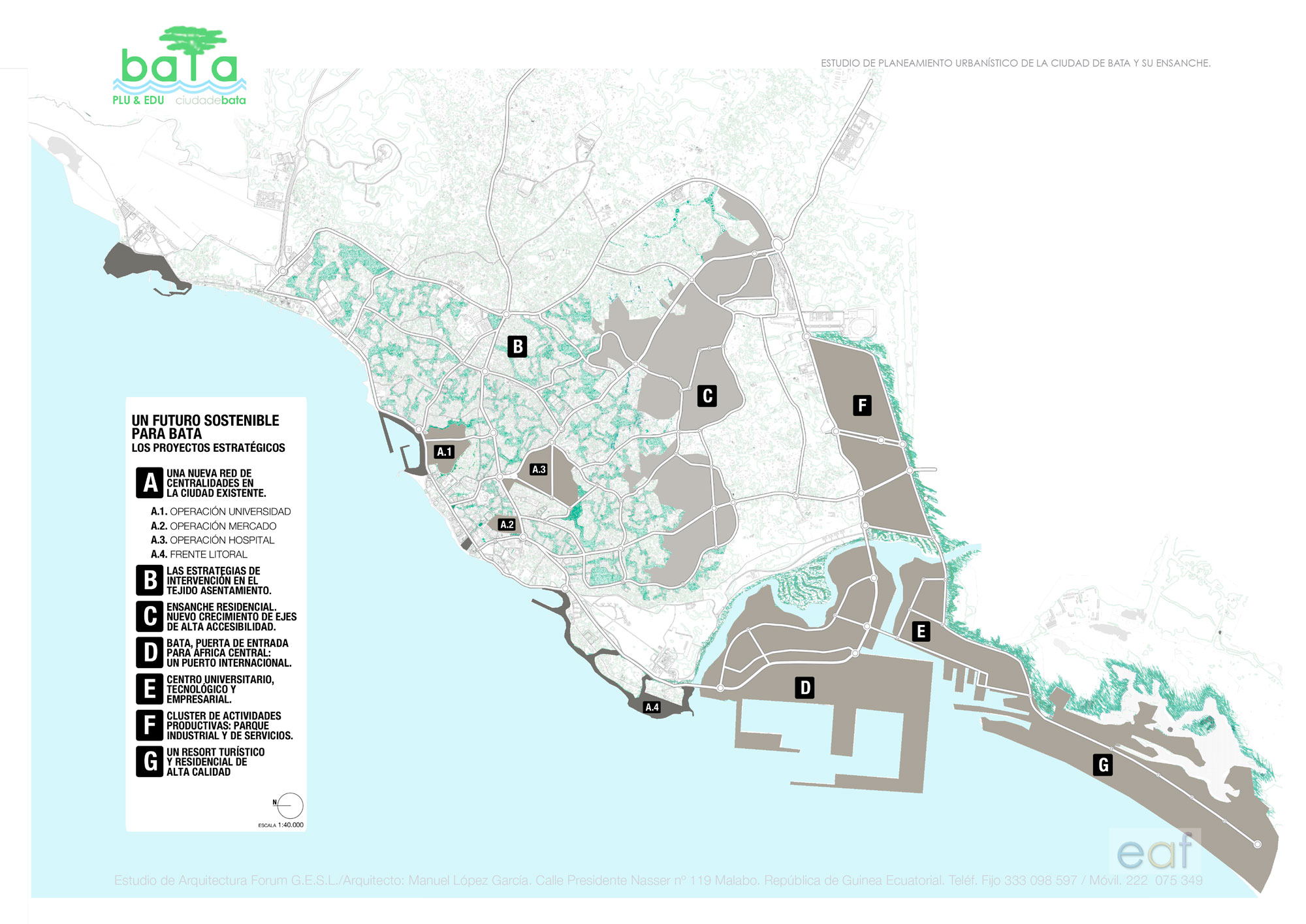
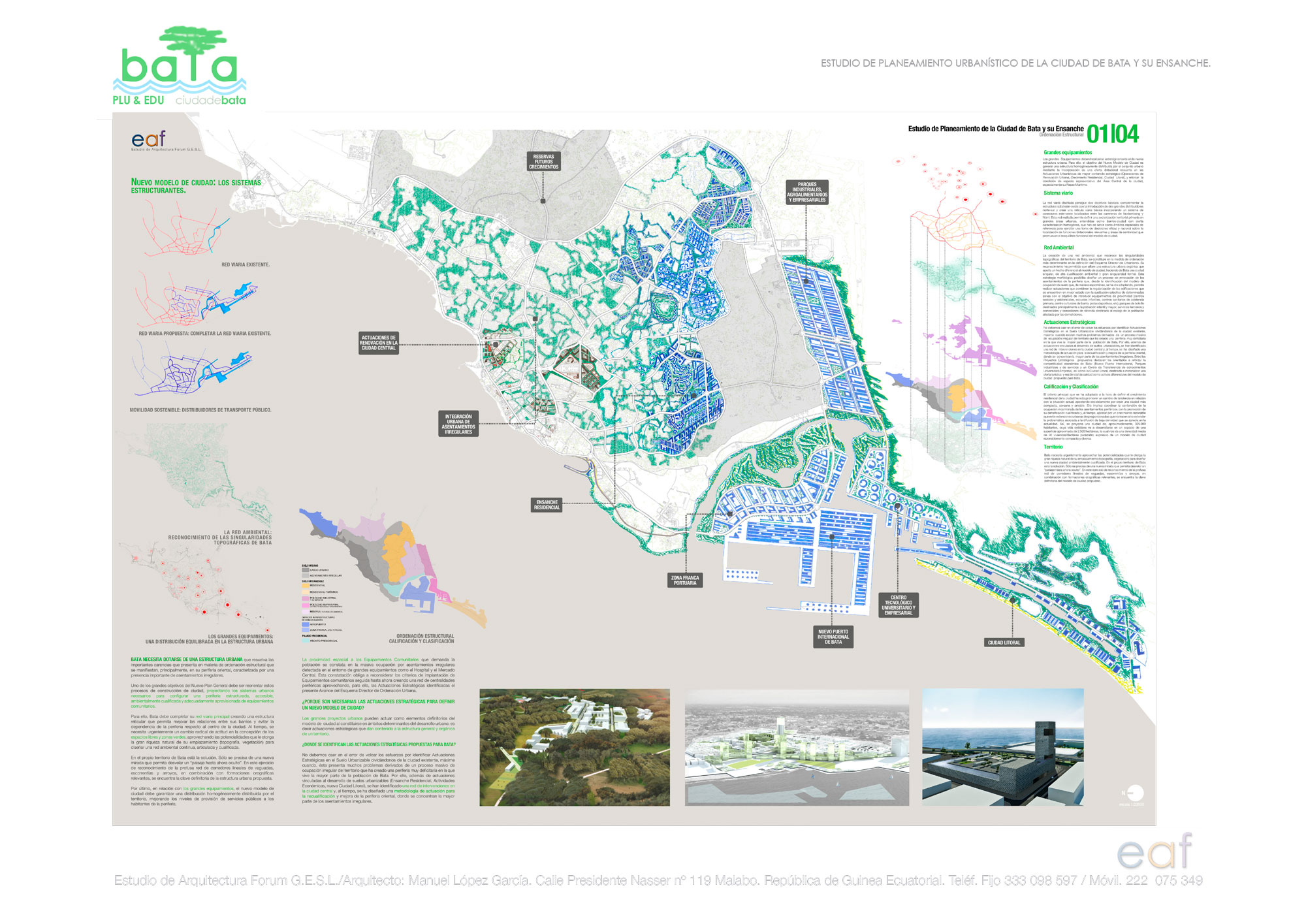
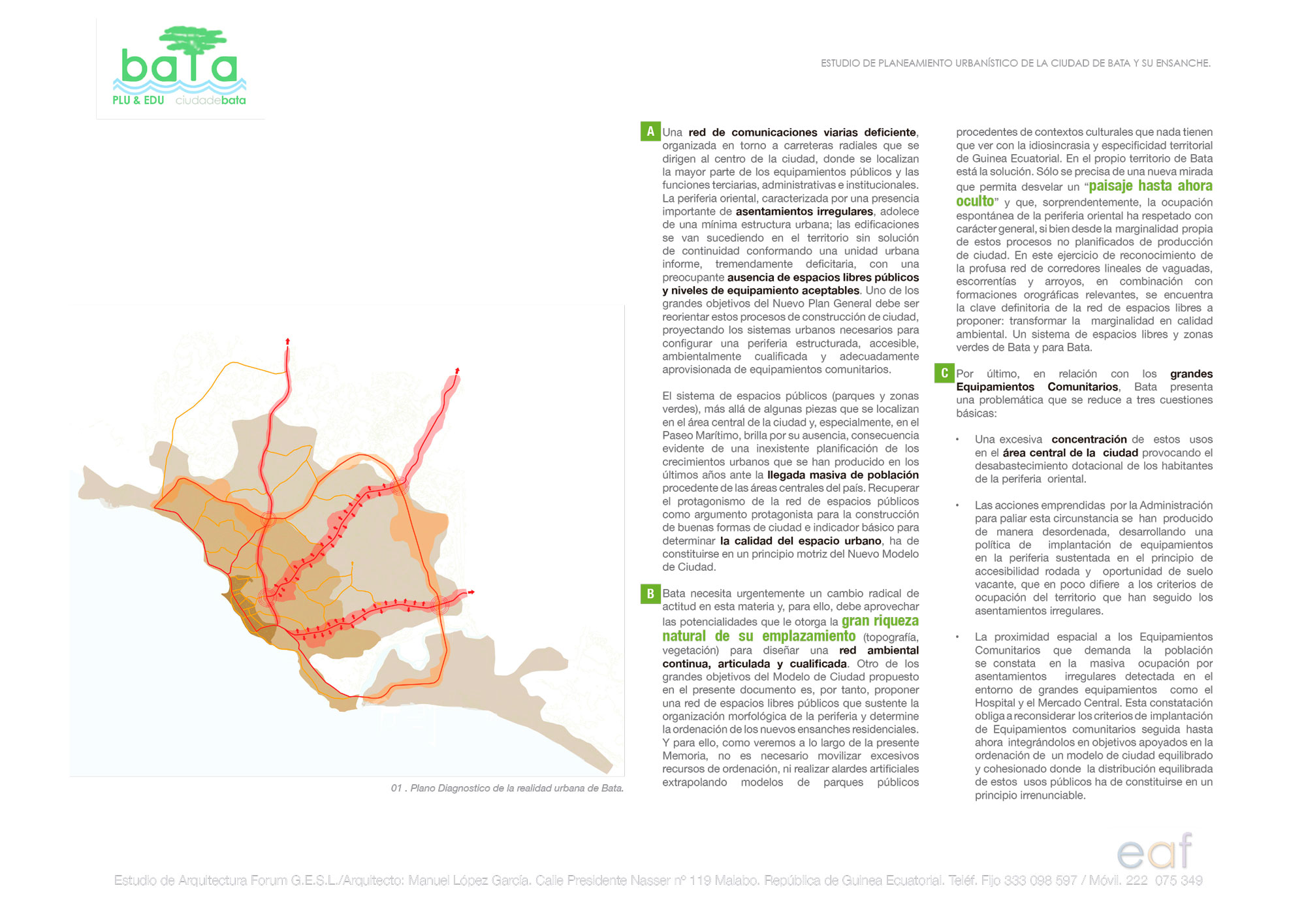
The city of Bata has shortcomings in terms of structural urban planning: deficient road communications network, absence of public spaces system, excessive concentration of community facilities in the central area and generation of new pieces on the periphery supported exclusively on the unsustainable principle of wheeled accessibility. Firstly, the new planning must (RE) STRUCTURE the road communication networks, establishing a new network of ACCESS to the environment of the port area and the littoral sector. Secondly, it must CONFORM an ENVIRONMENTAL NETWORK that recognizes the topographic, landscape and environmental singularities of the place. Finally, it must locate NEW EQUIPMENT strategically placed that should help REVERT the dysfunctions generated by the city. A series of STRATEGIC ACTIONS should be proposed in the central area of the city and a strategy of INTERVENTION in irregular settlements.
In collaboration with EAF Architecture Studio Forum G.E.S.L.