


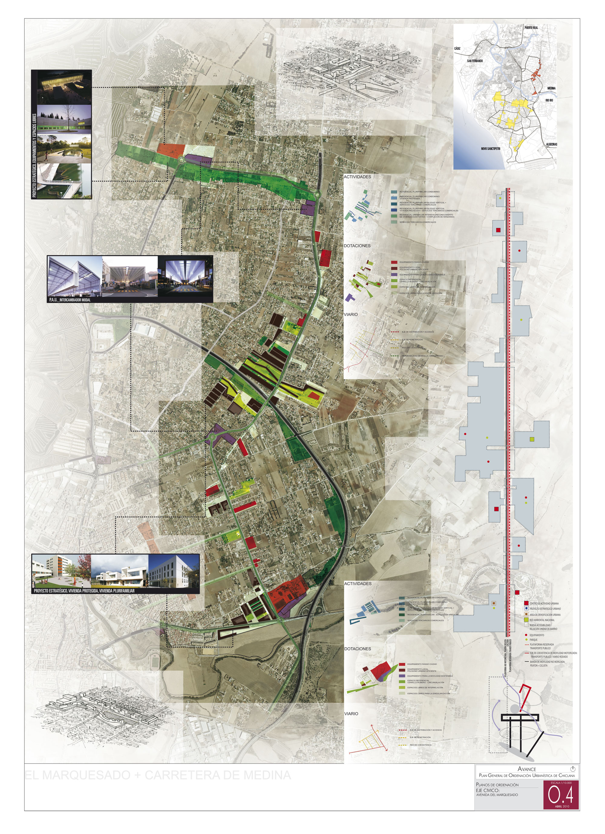
General Urban Development Plan of Chiclana
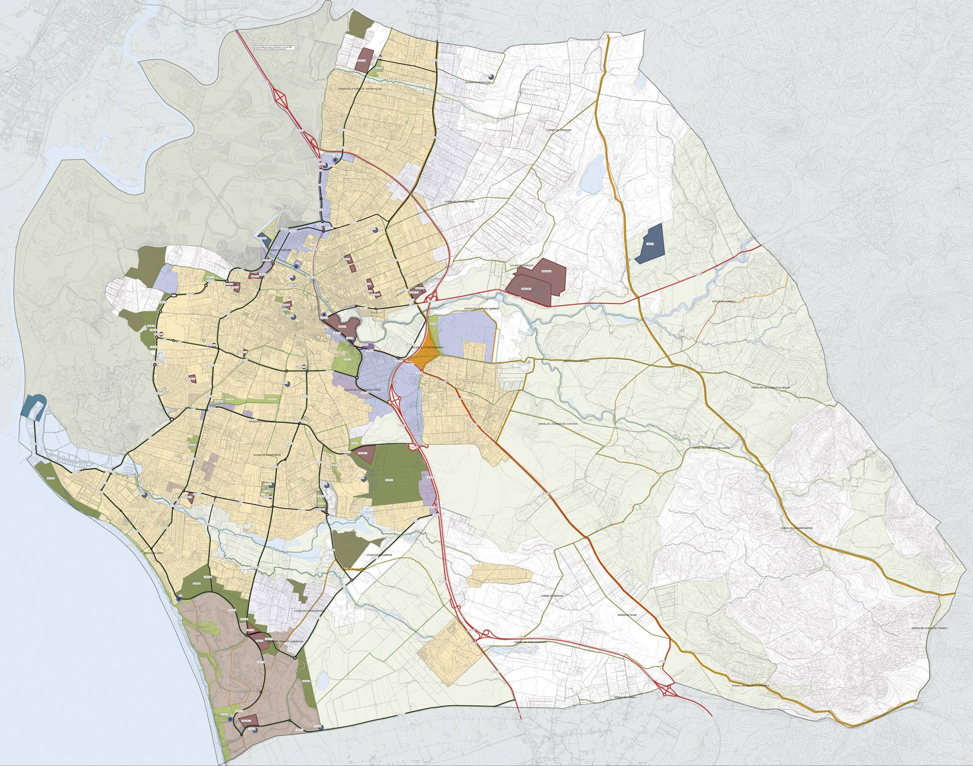
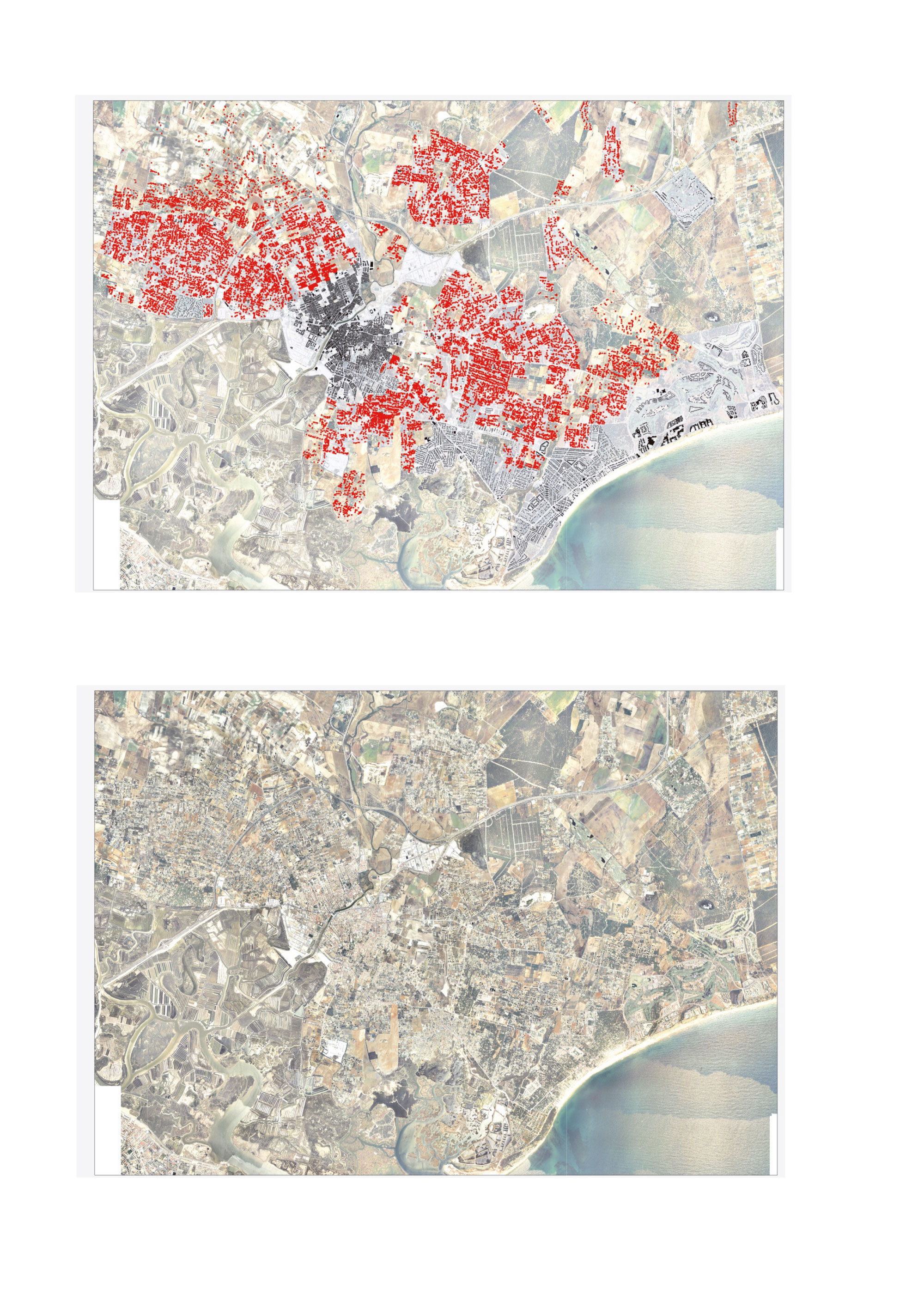
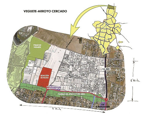
The Municipality of Chiclana has more than 20 million square meters of undeveloped land in which more than 13,000 houses are located irregularly. This singular characteristic makes it a PILOT EXPERIENCE for the REGULARIZATION AND ENVIRONMENTAL URBAN INTEGRATION of this type of city network.
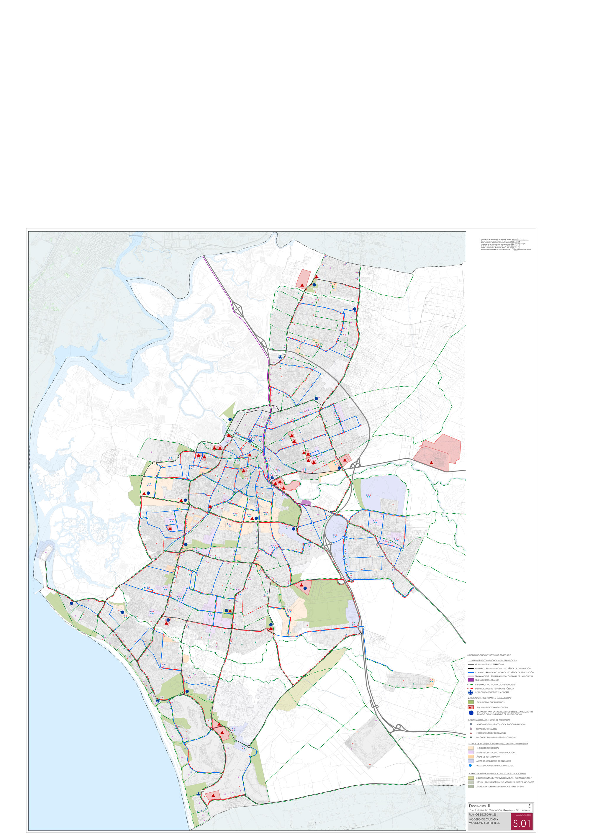
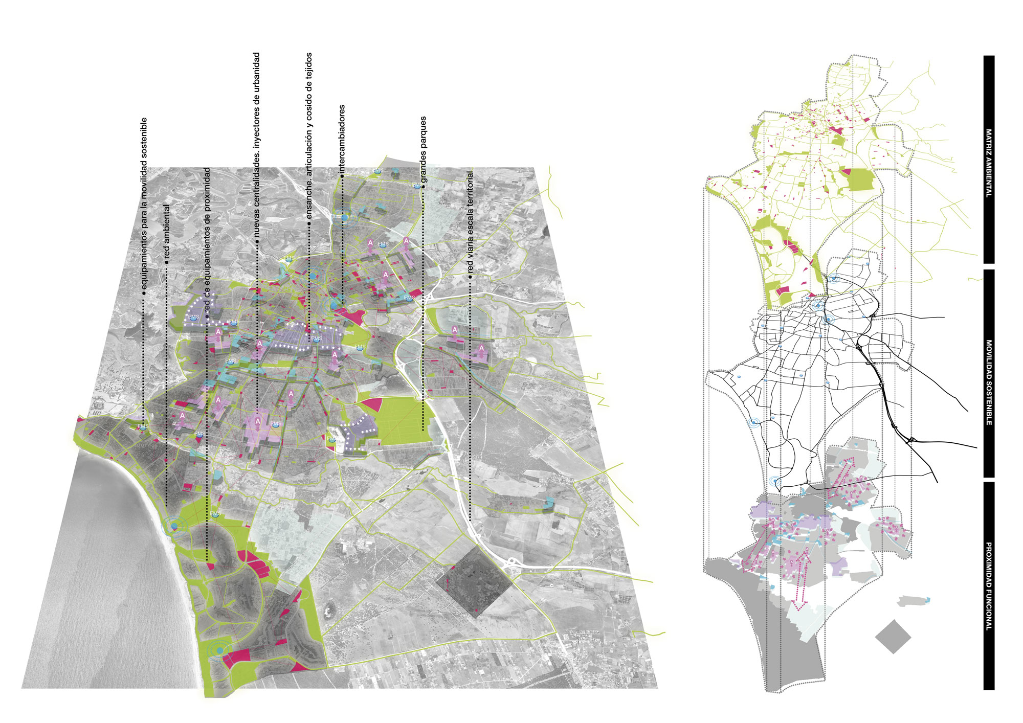
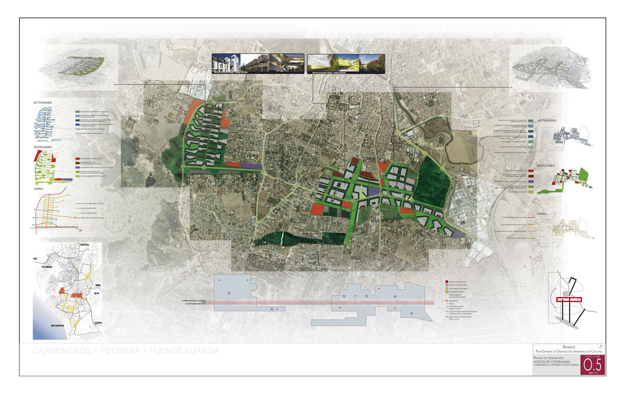
The new urban and territorial model, on which Local Development Framework (General Urban development plan) bets, is based on the following basic pillars;
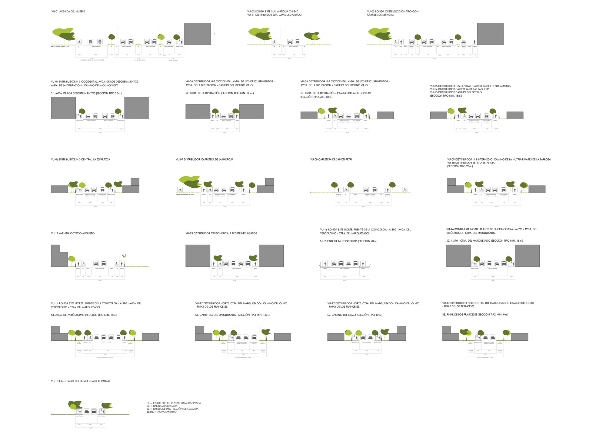
- SUSTAINABLE MOBILITY (reducing the use of the private automobile).
- PERIPHERAL CENTRALITIES (arranged in Nodes and Axes).
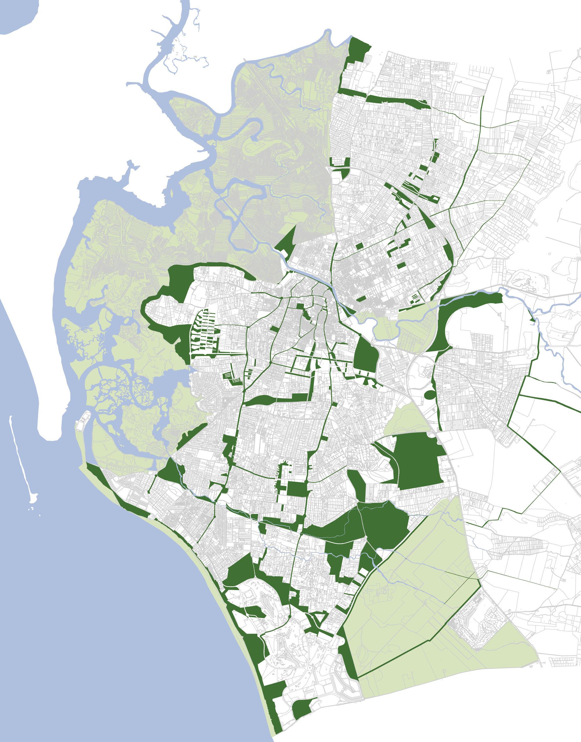
- And the incorporation of free spaces as the FREE SPACE AS THE MATRIX ELEMENT OF THE DESIGN (thereby forming a continuous network which articulates the large parks).